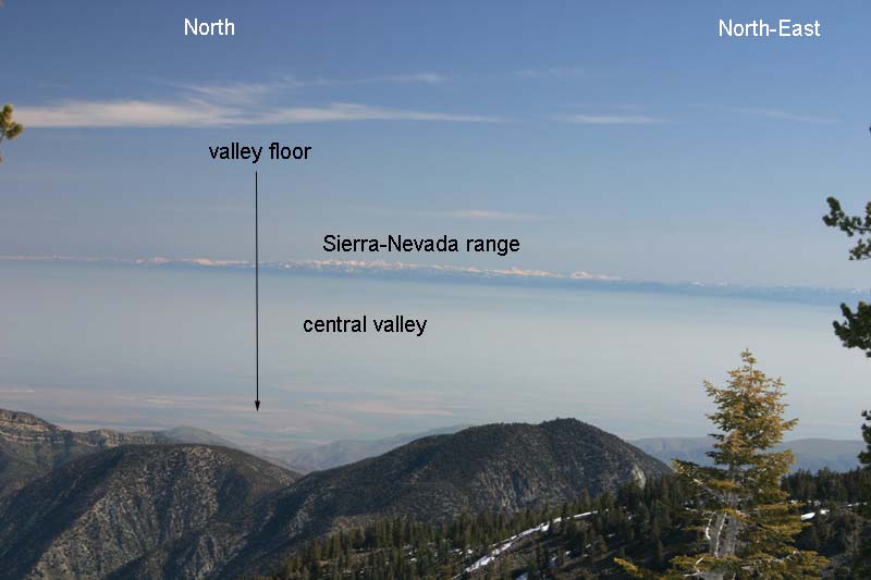
2005-05-12: This 55 mm image was taken from the summit of Mt. Pinos at elevation 8,831 ft. (2692 meters). The vista shows a good portion of California's central valley as well as the Sierra-Nevada range (roughly 100 to 200 miles distant and spanning North to North-East). Looking from binoculars (on a clear day like below) allows one to see individual peaks in the Sierra-Nevadas, such as Mt. Whitney (image below this).
2005-05-12: Mt. Whitney, the highest peak in the lower
48 United States, is barely visible in this blow-up of the image above.
Binoculars
and telephoto lenses with better, more-powerful optics can resolve
much more detail.

2005-05-12: Wide-angle (28 mm) image from same location
as above two images. I am in the foreground to the left.
