Mount Wilson: More Images from Summit on a Clear Day

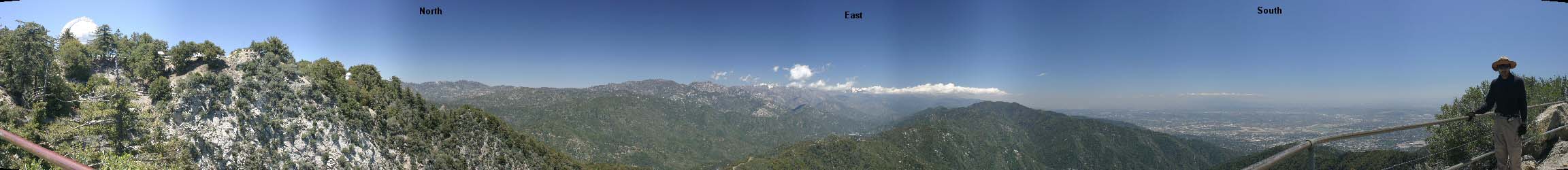
On Tuesday 10 may 2005, I took another trip to Mt. Wilson. High winds improved visibility towards urban areas allowing cityscapes to become visibile.

2005-05-10: This panorama was captured from Echo Rock on Mount Wilson. Note the improved atmospheric visibility over urban areas when compared
to this panorama captured 2005-04-26.
<---- Scroll this image left to right to see all ---->This panorama was captured from Echo Rock on Mount Wilson. Note the improved atmospheric visibility over urban areas when compared to the image capured from same location on 2005-04-26

Video: Mt. Wilson view: Zoom out from downtown Los Angeles. date: 2005-12-01
Camcorder, pointing South, zooms back from downtown Los Angeles. After the zoom-out stops,
in the left side of wide-angle shot, you can see Palos Verdes and Catalina Is.

Wide-angle image, taken near Mt. Wilson's visitor 
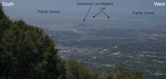
parking lot, showing vista from South-West (left) to West (right). date: 2005-05-10
Wide-angle image, taken near Mt. Wilson's visitor parking lot, showing vista from South-West (left) to West (right).

2005-05-10: A human eye field-of-view (55 mm) image taken from Western edge of Mt. Wilson's visitor parking lot.
A human eye field-of-view (55 mm) image taken from Western edge of Mt. Wilson's visitor parking lot.

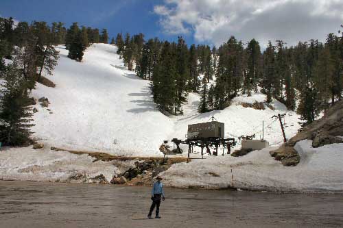
2005-05-03: Image taken from Mt. Waterman ski lift area. Elevation at the ski lift is ~6500 ft. Mt. Waterman lies roughly 20 miles North-East of
Mt. Wilson and can be accessed from Angeles Crest Highway.
Image taken from Mt. Waterman ski lift area. Elevation at the ski lift is ~6500 ft. Mt. Waterman lies roughly 20 miles North-East of

Technical info : All images taken with Canon Digital Rebel 300 EOS camera. Focus: manual. All other parameters: manual. Tripod was used.

top of page


khurramhashmi.org