Joshua Tree National Park: Keys View -- Panoramas, Videos, and
Geography
Below: 2005-09-05 (taken approximately 9:00 AM): This 120-degree
panorama -- comprised of 15 separate 50mm images -- was captured from Keys
View (elevation 5185 ft or 1581 m) in JTNP's south-west section. The foreground
mountains (in which Keys View is located) are known as the Little San Bernardino
mountains. Also note Signal Mountain, which is just past the Mexican border
nearly 110 miles to the south-east. The visibility on this morning was generally
good, allowing one to see such distant landmarks as well as clearly differentiate
more-nearby targets in the Coachella Valley and San Bernardino Wilderness.
<----
Scroll this image left
to right to see all ---->
<< Scroll this image left
to right to see all >>
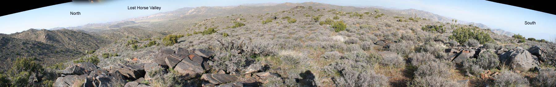
Below: 190° view from Keys View. This panorama shows essentially the scene behind the camera in the above
shot.
I had to move to a location about 500 feet above and a bit away from the main
viewing area (above).
The elevation here is about 5,100 ft. (1,555 meters) and the wind
currents from the San Gorgonio pass can be very powerful.
But that wind can be
put to practical, environmentally-conscious
use.
In late August 2006, my sister Faryal and friend Alison visited from Ohio. JTNP
was on top their sightseeing agenda! Here are photographs
from that visit. And below is some panoramic video we shot while at Keys View:
below: Timelapse, dusk from Keys View: Camera facing South-West toward Indio,
Palm Springs and Mt.
San Jacinto. If you look carefully, you can see the Palm Springs Ariel Tram
go up and down Mt. San Jacinto (the single, stationary dot is the Tram's
Mountain Station). Main traffic-way is I-10, running East-West. Some stars
are also visible as the sky darkens. Horizontal streaks are airplanes. Elevation
5200 ft
(click "HQ" when video starts playing for best quality)
More JTNP images, panographs and videos I've created: