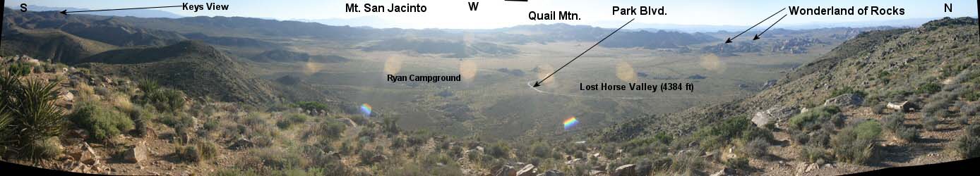

This is a popular short hike in Joshua Tree National Park because of the
spectacular views of the park and Southern California's highest peaks: San
Jacinto and San Gorgonio (blocked by the Sun's Glare in this photo; click here for a view taken earlier in the day). Try this short
but fun hike to the park's most-central highpoint.
The sweeping 360-degree views allow you to see many other areas in the park.
Distance: 3 miles RT
Elev. Gain: 1100 ft.
For more detailed information on summit hiking this mountain, visit this web site.
Visit Wikipedia's Joshua Tree National Park page for a brief overview of the park.
Technical stuff: All images taken with Canon Digital Rebel camera. Focus: manual. All other parameters: manual. A tripod was used. Panorama created with PTAssembler.