2005-07-14 and 2005-08-25: Mount Wilson, California, facing south-west; wide-angle lens setting: These time-lapse sequences were taken from Mount Wilson (elevation 5700 feet) on July 14, 2005 and August 25, 2005. Visibility was very good towards the south-west direction allowing one to see as far as Santa Catalina and Santa Barbara Island.
IMPORTANT NOTE: At the Internet-friendly resolution (640 x 480 pixels) used for the QuickTime movies below, one can barely discern some important details -- notably moving traffic. The original resolution of the master *.mov files are 3072 x 2048 pixels (!!), bettering HD and digital cinema by a good margin. Pioneering filmmaker, Tony Kern, developed this innovative process for his Mythopolis projects. Click here for more information.
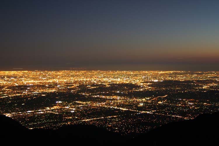
The first image below is a still from the first T-L sequence, a dusk-to-dark
transition, which was captured with an interval roughly equal to 8-10
seconds between frames (exposure time was 8 seconds).
Sample movie available on request.
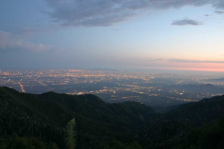
The second image below is a still from the second T-L sequence shot, almost
all night-time, which was captured with an interval roughly equal to
20-25 seconds
between frames (exposure time was 20 seconds).
Sample movie available on request.
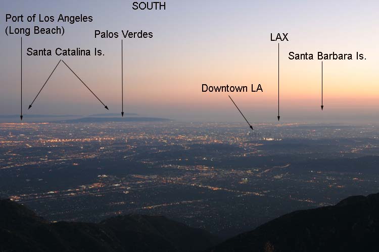
Below: 2005-08-25; Time: 19:50: A wide-angle (35 mm) image of Los Angeles from Mt. Wilson, facing south. The sun is beginning to set in the West (right). This is the first frame of a 182-frame time-lapse movie. Each frame required 3-seconds of exposure time. Frame-rate: 24 fps. The caption labels were added to this still for geographical information; they are not incorporated into the movie. Sample movie available on request.
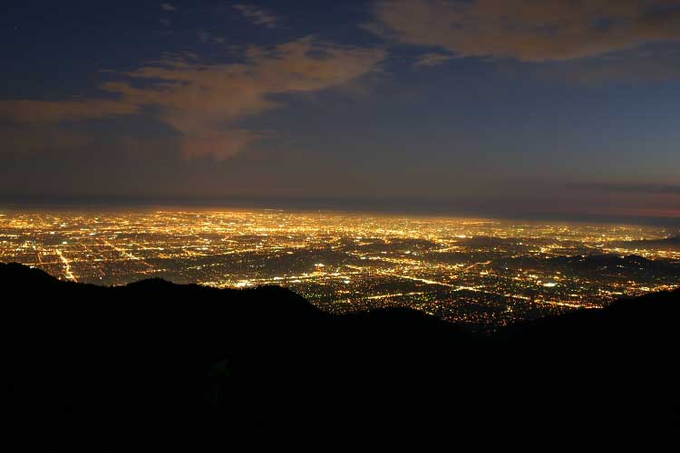
Below: 2005-08-25; Time: 20:10: A wide-angle (35 mm) image of Los Angeles from Mt. Wilson, facing south. This is the first frame of a 164-frame time-lapse movie. Each frame required 8-seconds of exposure time. Frame-rate: 24 fps. (QuickTime movie will be posted soon.)